
Weather
Tornado on the ground in Clarksville, Tennessee
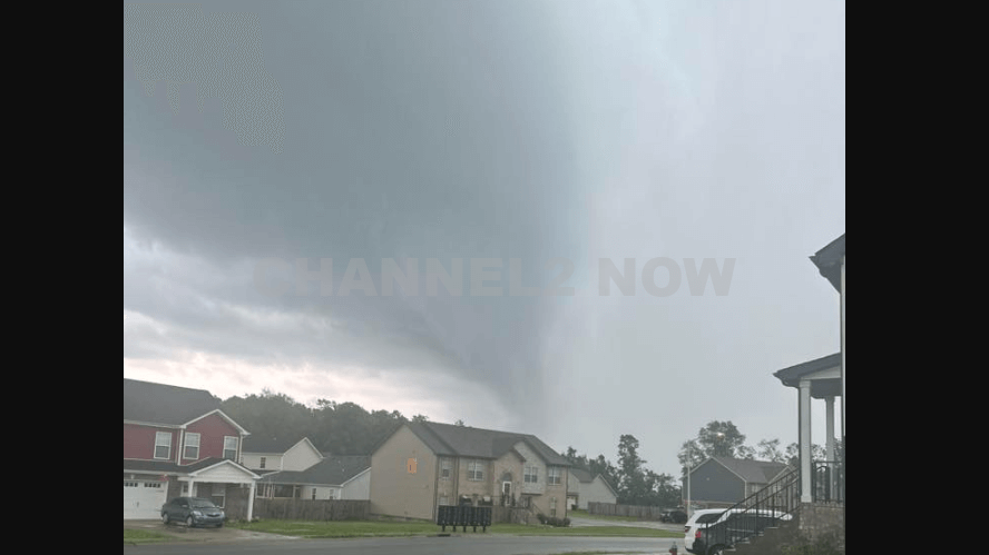
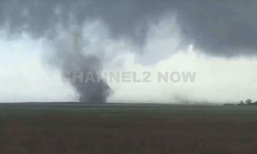
CLARKSVILLE, Tenn. — A confirmed tornado touched down in Clarksville late Tuesday afternoon, prompting urgent warnings and emergency precautions across the region.
According to the National Weather Service, the tornado was first confirmed at approximately 5:31 p.m. CDT, located about 8 miles south of Guthrie or 9 miles east of Clarksville.
The storm system was moving east at 50 mph, prompting a Tornado Warning for east-central Montgomery County, including areas near Lickskillet Road and surrounding communities.
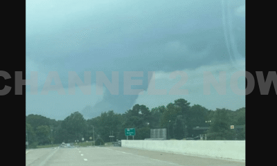
Residents in Clarksville and across Robertson County were urged to seek immediate shelter as multiple tornado-warned storms developed across Middle Tennessee.
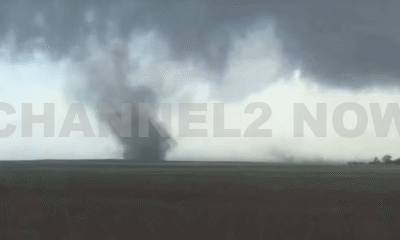
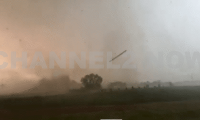
Law enforcement and weather agencies reported multiple funnel clouds and potential tornadoes across the Nashville metro area, stretching from Clarksville to below Spring Hill.
Severe weather reports also included large hail up to one inch and intense wind damage in affected areas.
One particularly dangerous cell was reported near Tylertown Road, tracking northeast toward Guthrie and Allensville, Kentucky.
Emergency officials are advising residents to remain vigilant, continue monitoring local weather updates, and avoid travel until the severe weather threat passes.
Stay tuned to official sources, including the National Weather Service and Smokey Barn News, for continuing live updates as the situation develops.


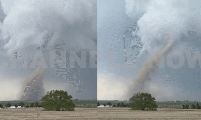


DENVER, CO — The National Weather Service (NWS) in Denver has issued a Tornado Warning for southwestern Logan County and north-central Washington County in northeastern Colorado, effective until 5:45 p.m. MDT Friday.
At 5:11 p.m., weather spotters confirmed a tornado on the ground near Merino, approximately 11 miles southwest of Sterling, moving southeast at 20 miles per hour.
The storm system is producing a dangerous and damaging tornado, with the potential for:
- Flying debris posing serious risk to those outdoors or in vehicles
- Structural damage to homes, roofs, windows, and vehicles
- Uprooted trees and downed power lines
- Total destruction of mobile homes
Communities directly in the path of the tornado include:
- Merino
- Prewitt Reservoir
- Atwood
- Logan Corners
- Willard
- Messex
Residents in these areas should seek shelter immediately. The safest option is to move to a basement or an interior room on the lowest floor of a sturdy building, away from windows and exterior walls.
Do not attempt to outrun the tornado in a vehicle. If no shelter is available, lie flat in a low-lying area and protect your head.
This is a confirmed tornado, not just radar-indicated. Immediate action is critical to ensuring safety.
Continue monitoring local media, NOAA weather radio, or official NWS alerts for real-time updates.