
Weather
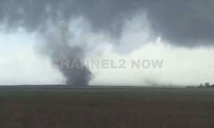
Large tornado on the ground near Bennett, Colorado
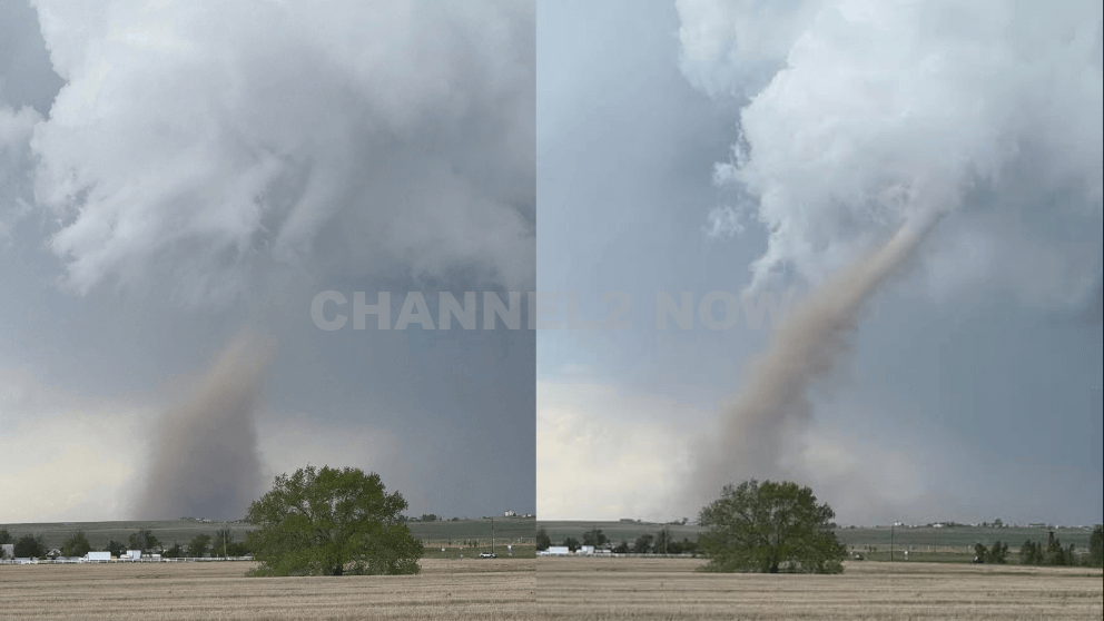
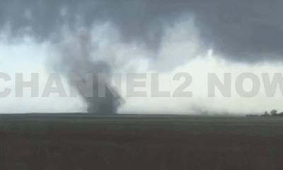
A series of tornadoes touched down in eastern Colorado on Sunday afternoon, with one large and potentially damaging tornado captured on a Colorado Department of Transportation (CDOT) traffic camera near Bennett.
The twister was seen crossing Interstate 70 east of Denver, between the towns of Bennett and Watkins, and was described by forecasters as potentially causing “significant damage.”
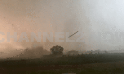
The National Weather Service (NWS) reported at least six tornado sightings across the region as severe thunderstorms swept through.
The tornado near Bennett was one of the most visible, with over a minute of dramatic footage recorded on a CDOT webcam, showing a well-defined funnel making contact with the ground just east of Denver International Airport.
The storm moved in a northeast direction, threatening areas including Wiggins, Hoyt, Fort Morgan, and Brush.
As of 2:30 p.m., two tornadoes were confirmed near Arapahoe Park, roughly 25 miles southeast of Denver, and three separate tornado reports came in from the Bennett area, located approximately 32 miles east of the city.
One tornado in particular, deemed “extremely dangerous” by the NWS, was confirmed on the ground around 1:50 p.m. about nine miles north of Strasburg. It was moving northeast at 20 miles per hour.
That tornado prompted a warning covering much of central Adams County, which was lifted by 2:15 p.m.
Meteorologists are still working to determine how many of Sunday’s tornado reports represent distinct tornadoes versus multiple sightings of the same storm system.
In addition to the tornado activity, large hail accompanied the storms. Reports of hail ranging from the size of dimes to ping pong balls were recorded across the region.
The largest confirmed hailstone as of mid-afternoon was 1.5 inches in diameter, reported near East Smoky Hill Road and South Powhaton Road in Aurora.
Emergency officials continue to monitor the situation and are assessing the extent of damage in affected areas.
Residents are urged to remain alert as cleanup efforts begin and as the threat of additional storms may persist into the evening.


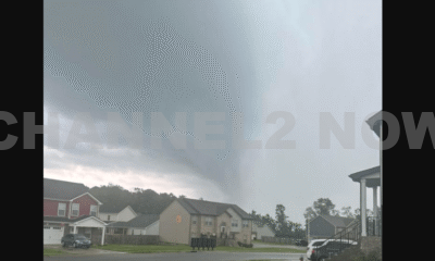


DENVER, CO — The National Weather Service (NWS) in Denver has issued a Tornado Warning for southwestern Logan County and north-central Washington County in northeastern Colorado, effective until 5:45 p.m. MDT Friday.
At 5:11 p.m., weather spotters confirmed a tornado on the ground near Merino, approximately 11 miles southwest of Sterling, moving southeast at 20 miles per hour.
The storm system is producing a dangerous and damaging tornado, with the potential for:
- Flying debris posing serious risk to those outdoors or in vehicles
- Structural damage to homes, roofs, windows, and vehicles
- Uprooted trees and downed power lines
- Total destruction of mobile homes
Communities directly in the path of the tornado include:
- Merino
- Prewitt Reservoir
- Atwood
- Logan Corners
- Willard
- Messex
Residents in these areas should seek shelter immediately. The safest option is to move to a basement or an interior room on the lowest floor of a sturdy building, away from windows and exterior walls.
Do not attempt to outrun the tornado in a vehicle. If no shelter is available, lie flat in a low-lying area and protect your head.
This is a confirmed tornado, not just radar-indicated. Immediate action is critical to ensuring safety.
Continue monitoring local media, NOAA weather radio, or official NWS alerts for real-time updates.