
Weather
Mass Casualty Incident Declared in Somerset After Large and Destructive Tornado

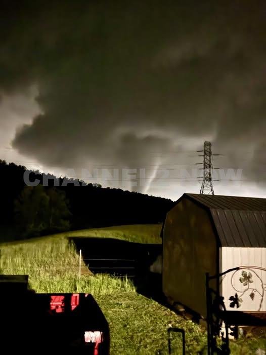
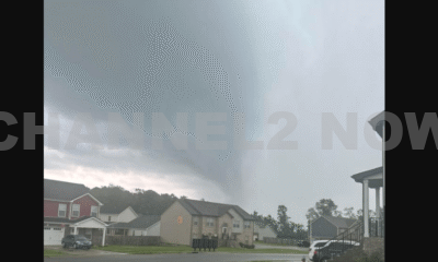
SOMERSET, KY — A mass casualty incident has been declared in Somerset, Kentucky, after a powerful tornado tore through the southern part of the city late Monday evening, causing widespread destruction and confirmed injuries.
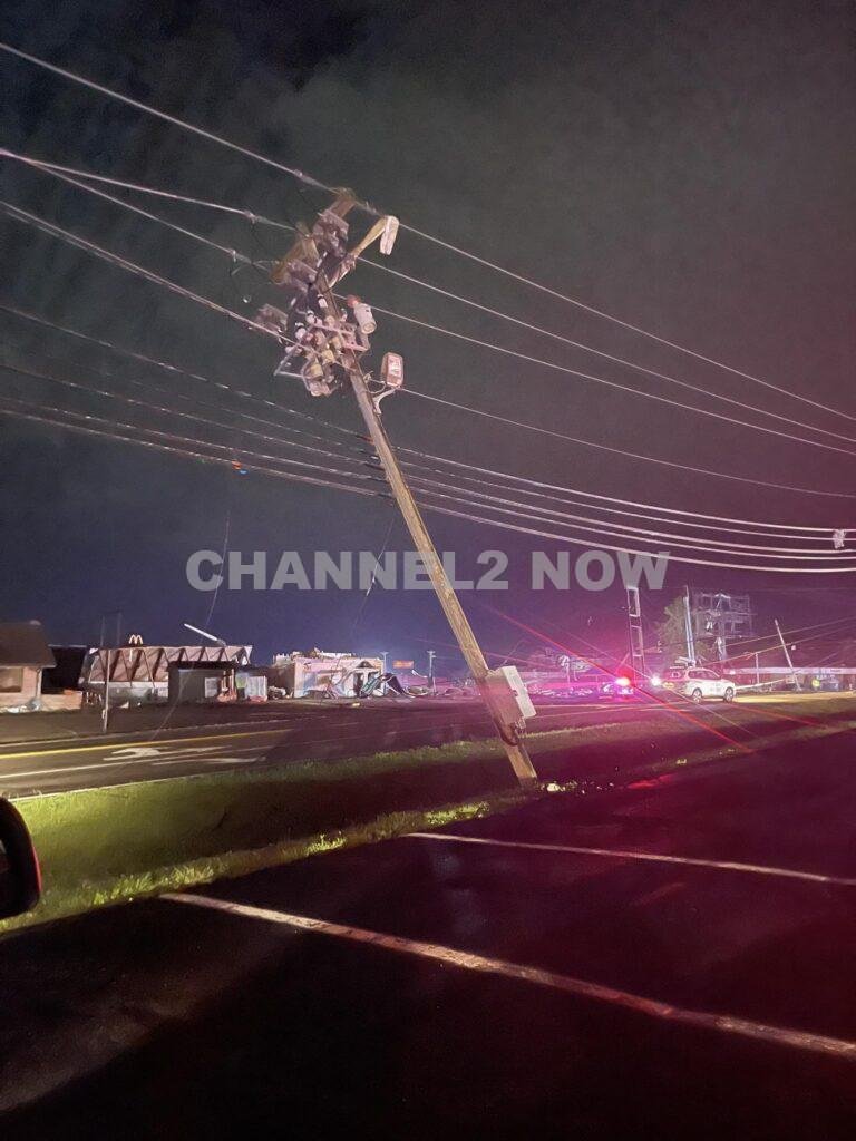
Emergency officials have reported major tornado damage along South Highway 27, particularly near Stoplight 22 and Parkers Mill Road.
According to the Somerset Fire Department, the southern portion of the city bore the brunt of the storm.
First responders are actively working in the affected zones, conducting search-and-rescue operations and attending to injured residents.
Video footage shared by residents shows the immense scale of the destruction, including flattened buildings, overturned vehicles, and large debris fields.
Emergency crews described the scene as “chaotic,” with multiple structures leveled and communications hindered due to infrastructure damage.
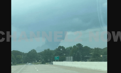
TORNADO PUMMELS LAUREL COUNTY
— News Channel3 Now (@newschannel3now) May 17, 2025
Several areas of Laurel County, including the Sunshine Hills area shown in this video, were struck by a tornado late Friday night. Multiple injuries have been reported. Ky. 363 is closed while the injured are evacuated and homes are searched. pic.twitter.com/nEeFkZBsso
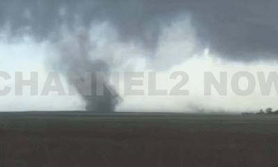
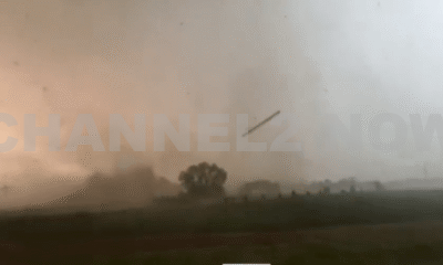
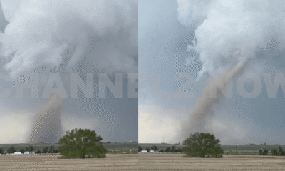
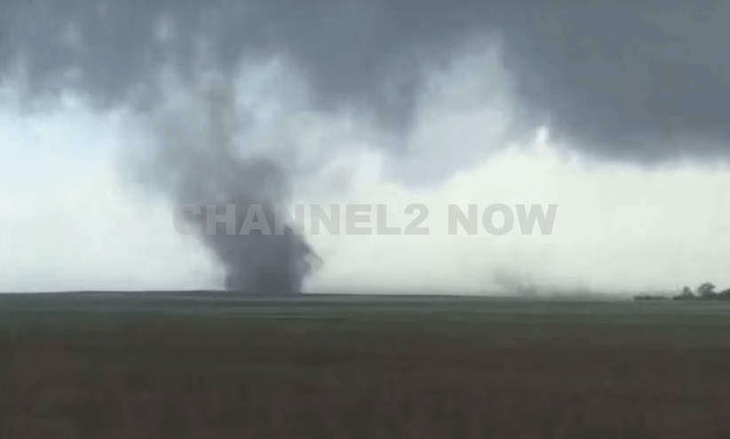
The National Weather Service issued a Tornado Emergency for Pulaski County as the storm system produced multiple large and destructive tornadoes, one of which carved a path through Somerset.
Radar imagery revealed a well-defined debris ball, indicating a confirmed tornado with significant debris being lofted into the air.


The system was observed moving east toward London, Kentucky, with the potential to reach the area within 10 to 15 minutes from initial tracking.
- Multiple injuries have been confirmed, though the exact number has not yet been released.
- Rescue operations are ongoing, with mutual aid being requested from neighboring counties.
- Major infrastructure damage reported, including downed power lines, destroyed homes, and blocked roadways.
- Residents are being urged to stay off the roads and avoid affected areas to allow emergency crews unimpeded access.
Authorities are working to assess the full extent of the damage and are urging anyone with injuries or structural damage to contact 911.
More information will be released as rescue operations and damage assessments continue.
This is a developing situation. Stay tuned to official channels for updates, and take immediate shelter if you are in the path of this dangerous weather system.


DENVER, CO — The National Weather Service (NWS) in Denver has issued a Tornado Warning for southwestern Logan County and north-central Washington County in northeastern Colorado, effective until 5:45 p.m. MDT Friday.
At 5:11 p.m., weather spotters confirmed a tornado on the ground near Merino, approximately 11 miles southwest of Sterling, moving southeast at 20 miles per hour.
The storm system is producing a dangerous and damaging tornado, with the potential for:
- Flying debris posing serious risk to those outdoors or in vehicles
- Structural damage to homes, roofs, windows, and vehicles
- Uprooted trees and downed power lines
- Total destruction of mobile homes
Communities directly in the path of the tornado include:
- Merino
- Prewitt Reservoir
- Atwood
- Logan Corners
- Willard
- Messex
Residents in these areas should seek shelter immediately. The safest option is to move to a basement or an interior room on the lowest floor of a sturdy building, away from windows and exterior walls.
Do not attempt to outrun the tornado in a vehicle. If no shelter is available, lie flat in a low-lying area and protect your head.
This is a confirmed tornado, not just radar-indicated. Immediate action is critical to ensuring safety.
Continue monitoring local media, NOAA weather radio, or official NWS alerts for real-time updates.