
Weather
Major flooding issues across parts of St. Louis Missouri
Significant flooding has impacted multiple areas throughout St. Louis, Missouri, causing widespread disruption and damage.
Heavy rainfall over recent hours has led to swollen rivers, overwhelmed storm drains, and flooded streets, leaving parts of the city and surrounding communities submerged.
Many neighborhoods in St. Louis are experiencing road closures as floodwaters make some streets impassable.

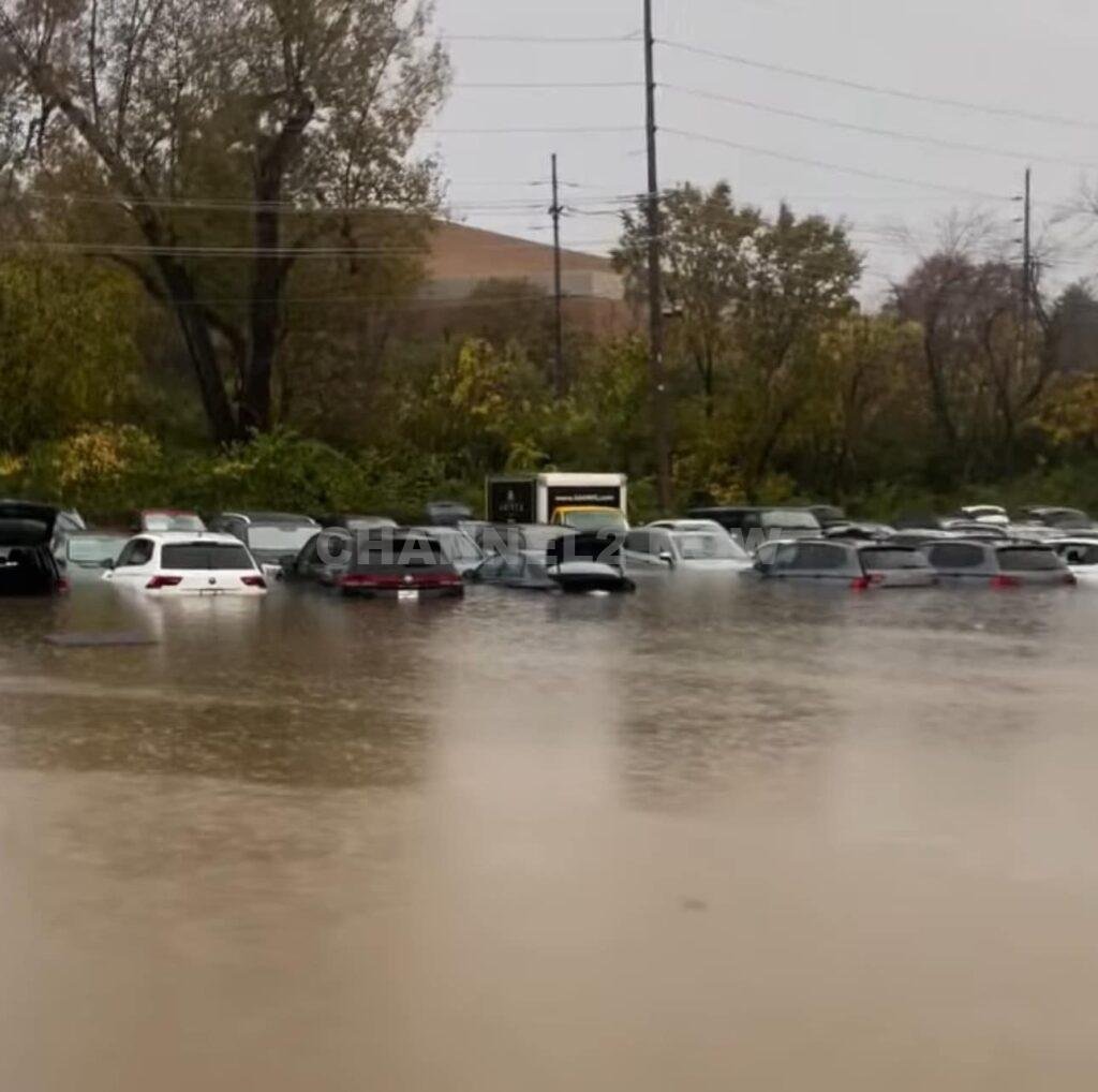
Emergency services have been responding to calls for assistance from residents stranded in their homes or vehicles, while local authorities have urged drivers to avoid any roads covered in water. Numerous vehicles have already been abandoned due to stalled engines and rising waters.
Reports indicate that several businesses and residential properties have been affected by water damage, with basements, parking garages, and lower floors flooding in low-lying areas.
In some neighborhoods, floodwaters have reached several feet, posing risks to both property and public safety. Local officials have opened temporary shelters for those displaced by the rising waters, and utility crews are on standby to address potential power outages in affected areas.
The National Weather Service has issued flood warnings for the St. Louis area, advising residents to monitor weather updates and stay alert for any changes in conditions.
Flash flooding remains a concern, as the saturated ground and overwhelmed drainage systems are expected to exacerbate any additional rainfall.
As emergency crews work tirelessly to manage the situation, authorities are urging the public to stay off the roads, seek higher ground if necessary, and remain indoors until conditions improve.
Residents in flood-prone areas have been advised to prepare for potential evacuation and secure belongings that could be affected by water damage.


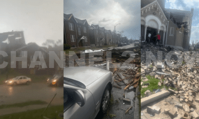


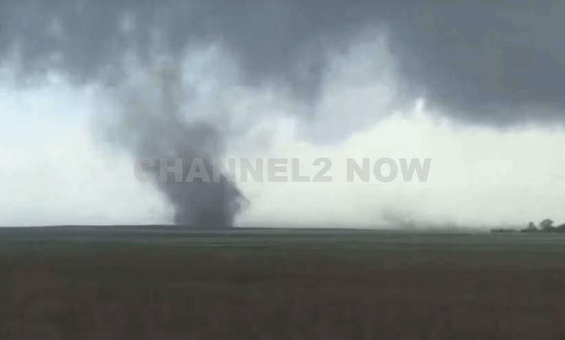
DENVER, CO — The National Weather Service (NWS) in Denver has issued a Tornado Warning for southwestern Logan County and north-central Washington County in northeastern Colorado, effective until 5:45 p.m. MDT Friday.
At 5:11 p.m., weather spotters confirmed a tornado on the ground near Merino, approximately 11 miles southwest of Sterling, moving southeast at 20 miles per hour.
The storm system is producing a dangerous and damaging tornado, with the potential for:
- Flying debris posing serious risk to those outdoors or in vehicles
- Structural damage to homes, roofs, windows, and vehicles
- Uprooted trees and downed power lines
- Total destruction of mobile homes
Communities directly in the path of the tornado include:
- Merino
- Prewitt Reservoir
- Atwood
- Logan Corners
- Willard
- Messex
Residents in these areas should seek shelter immediately. The safest option is to move to a basement or an interior room on the lowest floor of a sturdy building, away from windows and exterior walls.
Do not attempt to outrun the tornado in a vehicle. If no shelter is available, lie flat in a low-lying area and protect your head.
This is a confirmed tornado, not just radar-indicated. Immediate action is critical to ensuring safety.
Continue monitoring local media, NOAA weather radio, or official NWS alerts for real-time updates.