
Weather
Tornado Watch Issued for Parts of Louisiana, Arkansas, and Mississippi
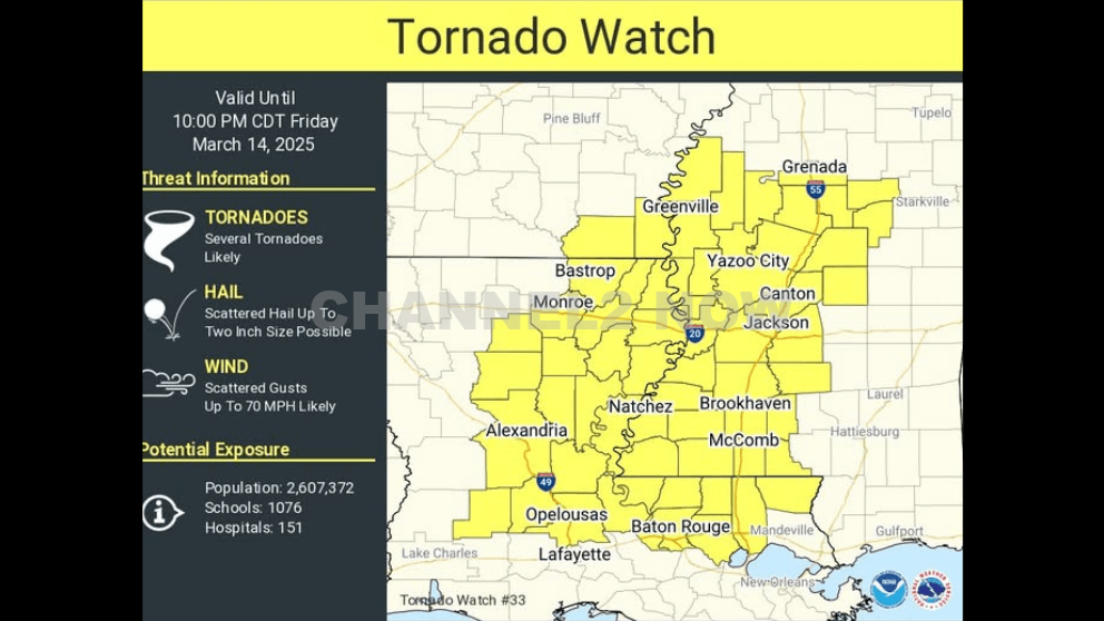
The National Weather Service (NWS) Storm Prediction Center has issued a Tornado Watch for portions of southeastern Arkansas, eastern and northeastern Louisiana, and western and southwestern Mississippi.
The watch is in effect from 5:00 PM until 10:00 PM CDT as conditions are highly favorable for severe weather, including tornadoes, large hail, and damaging wind gusts.
Affected Areas
In central Louisiana, the following parishes are included in the watch:
- Rapides
- Grant
- Allen
- Evangeline
- St. Landry
- Avoyelles
- LaSalle
- Catahoula
- Winn
- Concordia
Primary Threats
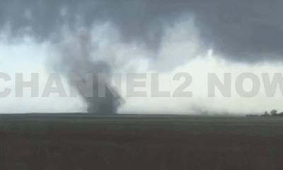
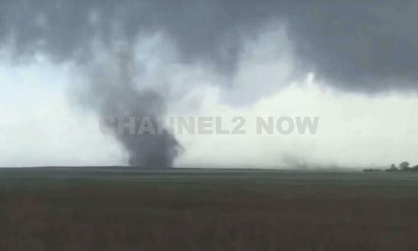
- Several tornadoes are possible, including the potential for strong and intense (EF2+) tornadoes.
- Scattered damaging wind gusts of up to 70 mph are likely.
- Scattered large hail is expected, with isolated instances of very large hail up to 2 inches in diameter possible.
Thunderstorm development is anticipated this afternoon and evening within a highly unstable and strongly sheared atmospheric environment across the Lower Mississippi Valley.
Given these conditions, supercell thunderstorms capable of producing all severe weather hazards, including large hail and strong tornadoes, are expected to develop.
The Tornado Watch covers an area approximately 65 miles east and west of a line extending from 65 miles south-southeast of Alexandria, LA, to 25 miles northwest of Greenwood, MS.
Residents in the affected areas should closely monitor weather alerts and have a severe weather safety plan in place.
Stay informed through official weather sources, including the National Weather Service, local emergency management, and NOAA Weather Radio. Additional warnings may be issued as the situation develops.


DENVER, CO — The National Weather Service (NWS) in Denver has issued a Tornado Warning for southwestern Logan County and north-central Washington County in northeastern Colorado, effective until 5:45 p.m. MDT Friday.
At 5:11 p.m., weather spotters confirmed a tornado on the ground near Merino, approximately 11 miles southwest of Sterling, moving southeast at 20 miles per hour.
The storm system is producing a dangerous and damaging tornado, with the potential for:
- Flying debris posing serious risk to those outdoors or in vehicles
- Structural damage to homes, roofs, windows, and vehicles
- Uprooted trees and downed power lines
- Total destruction of mobile homes
Communities directly in the path of the tornado include:
- Merino
- Prewitt Reservoir
- Atwood
- Logan Corners
- Willard
- Messex
Residents in these areas should seek shelter immediately. The safest option is to move to a basement or an interior room on the lowest floor of a sturdy building, away from windows and exterior walls.
Do not attempt to outrun the tornado in a vehicle. If no shelter is available, lie flat in a low-lying area and protect your head.
This is a confirmed tornado, not just radar-indicated. Immediate action is critical to ensuring safety.
Continue monitoring local media, NOAA weather radio, or official NWS alerts for real-time updates.