
Weather
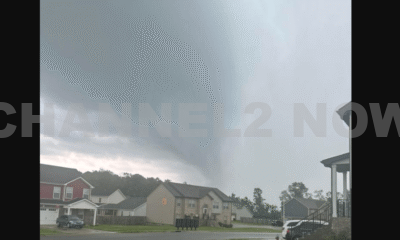
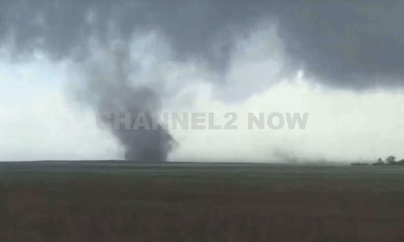
Tornado on the ground near Katy, Texas
Reports of potential tornado activity have emerged in the Katy Hockley and Bridgeland areas. However, as of now, there have been no calls regarding structural damage or injuries associated with these reports.
Authorities continue to monitor the situation closely.
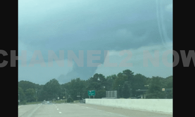
A Dense Fog Advisory is in effect for Southeast Texas from Friday night through Saturday morning. Drivers should exercise caution and be prepared for significantly reduced visibility during the morning commute.
- Spotty rain showers and isolated thunderstorms are possible ahead of an approaching cold front.
- Coastal areas may experience some early storm activity around sunrise, though these storms are not expected to match the intensity of the severe weather experienced on Thursday.
- A cold front will move through the region, bringing scattered storms. While the overall risk of severe weather remains low, there is a 2 out of 5 chance (Slight Risk) for isolated severe storms.
- Residents across Southeast Texas are advised to stay alert, as conditions can change rapidly.
- The line of storms is expected to clear the area by approximately 5:00 PM on Saturday as the front pushes eastward toward Louisiana.
High-pressure systems will move in behind the cold front, providing a calmer and more stable weather pattern. Expect drier conditions and cooler temperatures on Sunday.
- Stay updated with local weather alerts and forecasts.
- Exercise caution while driving during foggy conditions or heavy rainfall.
- Have a plan in place and know where to seek shelter if severe weather develops.
The National Weather Service and local authorities will continue to provide updates as needed. Residents are encouraged to monitor conditions and stay safe throughout the weekend.
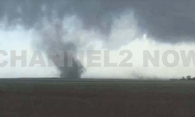


DENVER, CO — The National Weather Service (NWS) in Denver has issued a Tornado Warning for southwestern Logan County and north-central Washington County in northeastern Colorado, effective until 5:45 p.m. MDT Friday.
At 5:11 p.m., weather spotters confirmed a tornado on the ground near Merino, approximately 11 miles southwest of Sterling, moving southeast at 20 miles per hour.
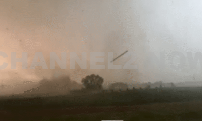
The storm system is producing a dangerous and damaging tornado, with the potential for:
- Flying debris posing serious risk to those outdoors or in vehicles
- Structural damage to homes, roofs, windows, and vehicles
- Uprooted trees and downed power lines
- Total destruction of mobile homes
Communities directly in the path of the tornado include:
- Merino
- Prewitt Reservoir
- Atwood
- Logan Corners
- Willard
- Messex
Residents in these areas should seek shelter immediately. The safest option is to move to a basement or an interior room on the lowest floor of a sturdy building, away from windows and exterior walls.
Do not attempt to outrun the tornado in a vehicle. If no shelter is available, lie flat in a low-lying area and protect your head.
This is a confirmed tornado, not just radar-indicated. Immediate action is critical to ensuring safety.
Continue monitoring local media, NOAA weather radio, or official NWS alerts for real-time updates.